Trial e-Resource – Geofacets (map-based research tool)
We are very pleased to offer a trial of Geofacets, an innovative map-based research tool, until 3 December 2014.
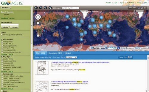
Geofacets is a geological mapping and research tool which provides instant access to maps and research journals from Elsevier, the Geological Society of London, the Society of Economic Geologists, the Society for Sedimentary Geology and the Geological Society of America.
Over 375,000 peer-reviewed maps are included, the majority of which are georeferenced and can be integrated with other applications such as GIS software (including ArcGIS), Google Earth and Petrel.
Maps cover Paleogeography, Oceanography, Geophysics, Hydrology and Hydrogeology, Meteorology/Climatology and Geography.
They are easily discoverable via geographic or keyword searches. Information about each map's original context from the source publication is included, and can be integrated into GIS and presentation programs, along with the maps.
Geofacets benefits researchers by freeing up time to spend on building stronger analyses and interpretation, and less time on searching.
NB: take a look at the Geofacets training and support page for detailed how-to videos, user guides and FAQs